Pre-Install Scanning: The Hidden Profit Driver for Equipment Suppliers

Installation performance is a critical part of every equipment deployment. When equipment arrives onsite, it must align with actual field conditions—bolt patterns, elevations, clearances, and supporting infrastructure. Yet many equipment suppliers still receive incomplete, outdated, or dimensionally unreliable drawings from customers. This gap between expected conditions and actual conditions leads to delays, redesigns, and unnecessary […]
Reality Capture: The Standard for Engineering Precision
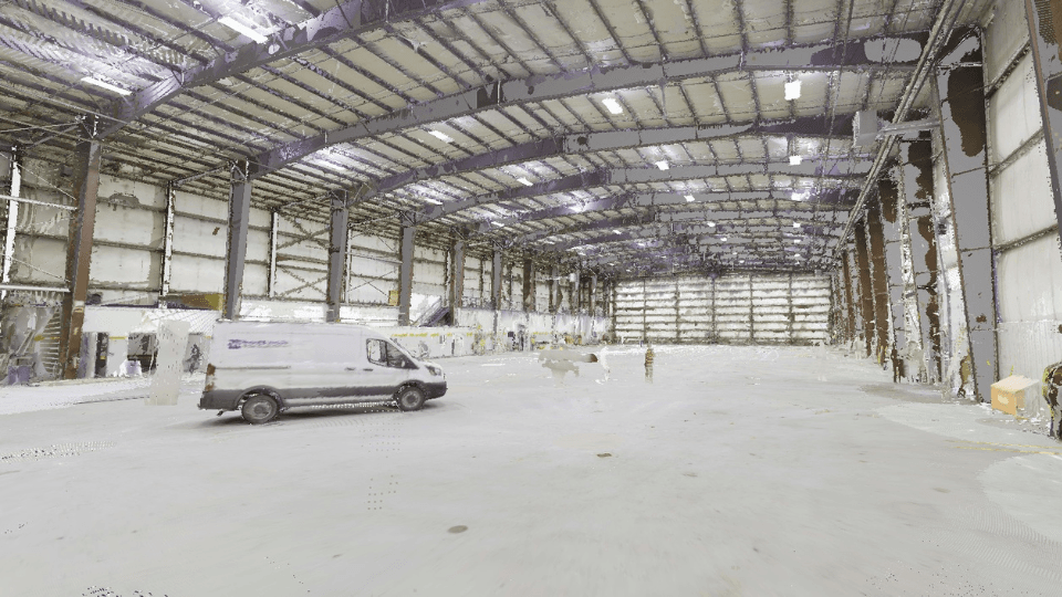
Paper plans and flat CAD files disconnect teams from the reality of the built environment. The result? Mismatched conditions, missed details, and costly rework. When designs are built on outdated information, every step of the process becomes vulnerable to error. Every outdated drawing introduces risk. Every site revisit adds cost. Every misalignment delays delivery. Engineering […]