


Accuracy in assessing existing conditions is critical to project success. Traditionally, this process has relied on manual measurements and dated, unreliable 2D CAD drawings that could be decades old—methods prone to human error, slow turnaround times, and incomplete data. As timelines tighten and project complexity increases, the need for more precise, efficient, and collaborative approaches becomes essential. Laser scanning for existing conditions offers a solution.
At OAR, we integrate laser scanning technology, particularly in the context of existing conditions, into our spatial and operational planning processes to deliver unmatched accuracy and speed. For project owners seeking to reduce delays and unforeseen costs, laser scanning offers a transformative solution.
Utilizing Laser Scanning for Existing Conditions to Enhance Project Accuracy
Laser scanning, or LiDAR (Light Detection and Ranging), captures precise 3D representations of real-world environments by emitting laser beams and measuring their return time. This creates a detailed point cloud that can be converted into highly accurate digital models of structures, landscapes, and mechanical systems.
Compared to traditional 2D CAD drawings, laser scanning delivers:
- Comprehensive spatial awareness
- Higher dimensional accuracy
- Faster data capture with minimal disruption
This 3D data serves as a reliable foundation for planning, design, clash detection, and ongoing coordination.
Why Early Adoption of Laser Scanning Matters
Enhanced Data Accuracy
Manual measurements leave room for interpretation and inconsistencies. Laser scanning removes the guesswork:
- Produces millions of data points for precise spatial representation
- Reduces errors related to human oversight
- Enables the creation of intelligent 3D models that reflect actual site conditions
Significant Time Savings
Laser scanning for existing conditions collects comprehensive site data in hours instead of days or weeks. This accelerates project timelines dramatically. With OAR’s process, we deliver:
- Rapid mobilization and scanning with minimal site disruption
- Fast turnaround on 3D models, enabling earlier decision-making
- Reduced time spent on rework or field verification
Improved Collaboration & Coordination
Having a shared, visual, and data-rich model enables real-time collaboration between architects, engineers, contractors, and owners:
- Stakeholders access the same trusted source of site information
- Reduces miscommunication and guesswork
- Enhances multidisciplinary coordination and problem-solving in early stages
Real-World Results: Capturing Existing Conditions for a Food Manufacturing Facility


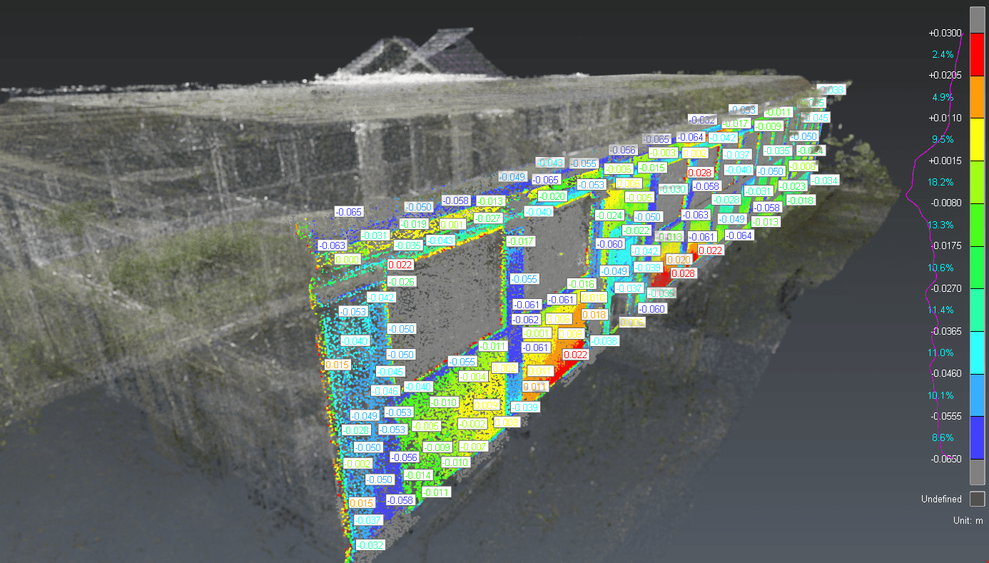
In a recent reconstruction project of a food manufacturing facility, OAR was hired to perform laser scanning for existing conditions as the first step in the project analysis. Within 72 hours of the site visit, our team produced a colorized point cloud of the entire 120,000-square-foot facility. We shared the data with structural, mechanical, and conceptual designers, saving them weeks or months of site visits.
Next, we produced a 3D as-built Revit model from the point cloud, as well as 2D plan sections and elevation views, to design constructible concepts. Dozens of inaccuracies were noted and identified within the project owner’s existing conditions drawings when compared to the highly accurate 3D scan generated by OAR. If concept design had proceeded only using a few site visits and outdated documentation, substantial problems would have been encountered downstream.
The results:
- Reduced construction rework by 40%
- Accelerated design handoff by 5 weeks
- Uncovered dozens spatial conflicts that would have otherwise gone unnoticed until construction
- Reduced the average cost of construction bids by 20% by increasing contractor confidence in designs and by developing accurate 3D quantity take-offs in 3D construction bid packages.
- Stakeholders stayed aligned, and construction began with confidence and clarity.
What Are the Challenges?
While laser scanning offers transformative benefits, its implementation isn’t without challenges:
- Initial Investment: Quality scanners and software come at a cost, but ROI is rapid through fewer delays and change orders.
- Skill Requirements: Teams need training to interpret point clouds and manage BIM integration.
- Data Management: large data sets require structured workflows and storage systems.
OAR overcomes these hurdles through in-house expertise, robust workflows, and collaborative project management.
Conclusion: A Competitive Advantage Starts with Better Data
Laser scanning is no longer just a “nice-to-have” for construction planning—it’s a strategic tool that accelerates schedules, reduces risk, and fosters project-wide alignment.
At OAR, we believe better data leads to better outcomes. By integrating laser scanning early in the project lifecycle, we give clients the confidence and clarity needed to build smarter, faster, and more collaboratively.