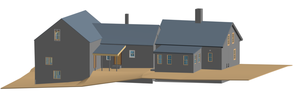
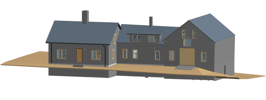
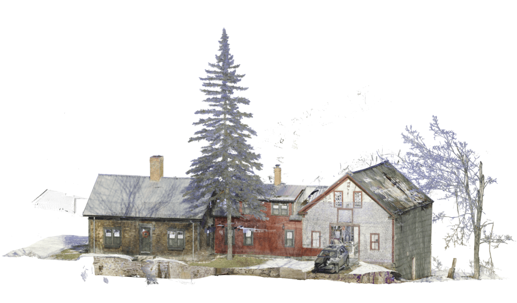
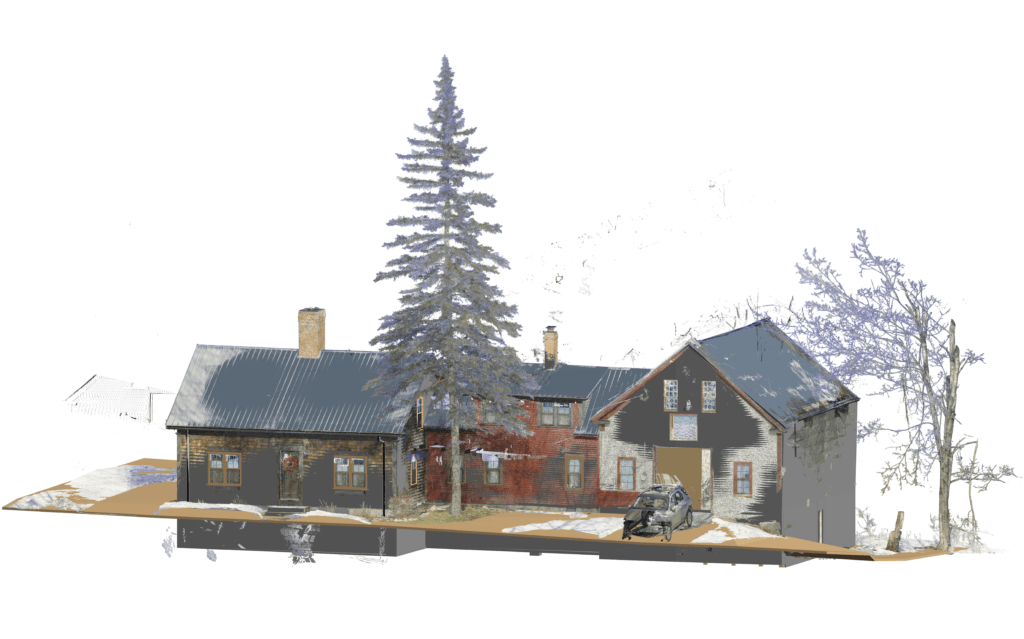
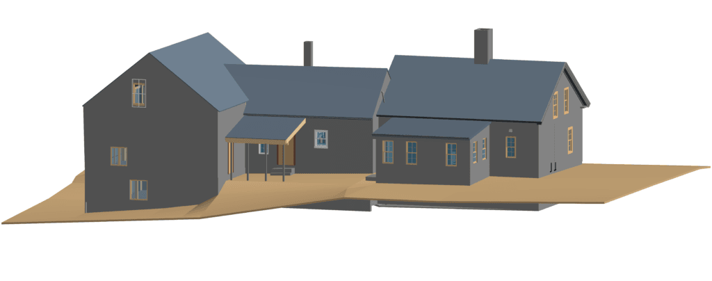
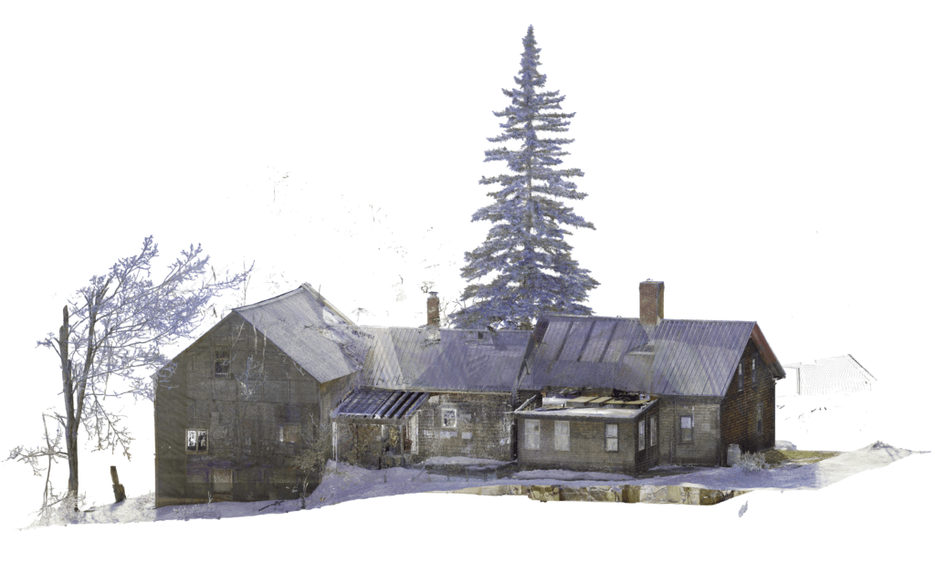
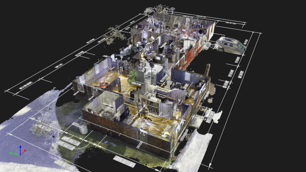
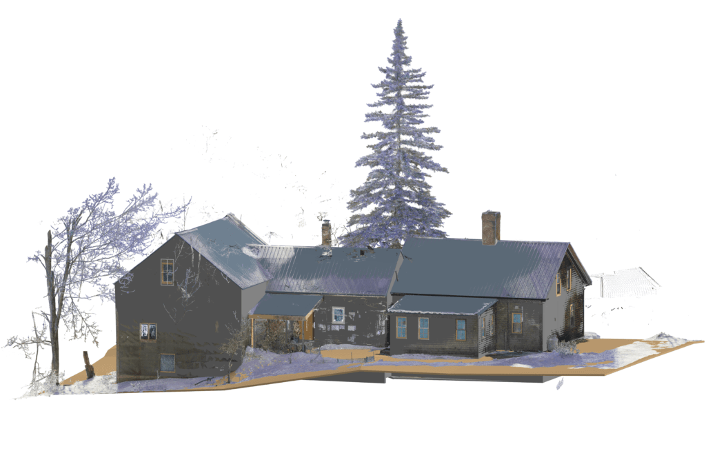
The Maine Farmhouse residential project highlights our expertise in delivering precise, actionable data for complex renovations. Tasked with documenting the existing conditions of an aging residential property, we utilized advanced scan-to-plan technology to enable a remote architect to efficiently design the remodel. Through high-accuracy LiDAR scanning,360-degree imagery, and seamless data hosting on the Cintoo platform, we facilitated a smooth design process without the need for repeated site visits or manual measurements.
Senior Integrations Designer, Waste Management Engineering Department
OAR’s team has been great to work with throughout multiple large-scale scan to BIM projects. High attention to detail, accurate scan data, proper BIM implementation and consistent communication/support from OAR has helped to improve our project quality and efficiency from start to finish.
I hired OAR to do a pre-construction scan to point cloud mesh and 2D CAD of my new building. I am glad I did… with Jon and Ryan this business goes above and beyond
Owner, TBJ Gourmet Food Manufacturing Plant
OAR attacks their projects methodically & professionally asking detailed questions regarding our final needs to fabricate. End result was a spectacular fit of formed powder coated aluminum angle under our cable guardrail system. Can’t wait to work with OAR on the next project!
President, Multi-Weld Services INC.
Ready to take the next step?
You’ve read about us, and now we’d love to hear about you. Reach out today, and let’s talk about accelerating design and construction together.

1 New Hampshire Ave Suite 125, Newington, NH 03801, USA
Mon-Fri: 8AM-5PM
info@oarscanning.com