Industrial Bakery in the Caribbean

laser scanning of a old industrial bakery in Jamaica

About the Project

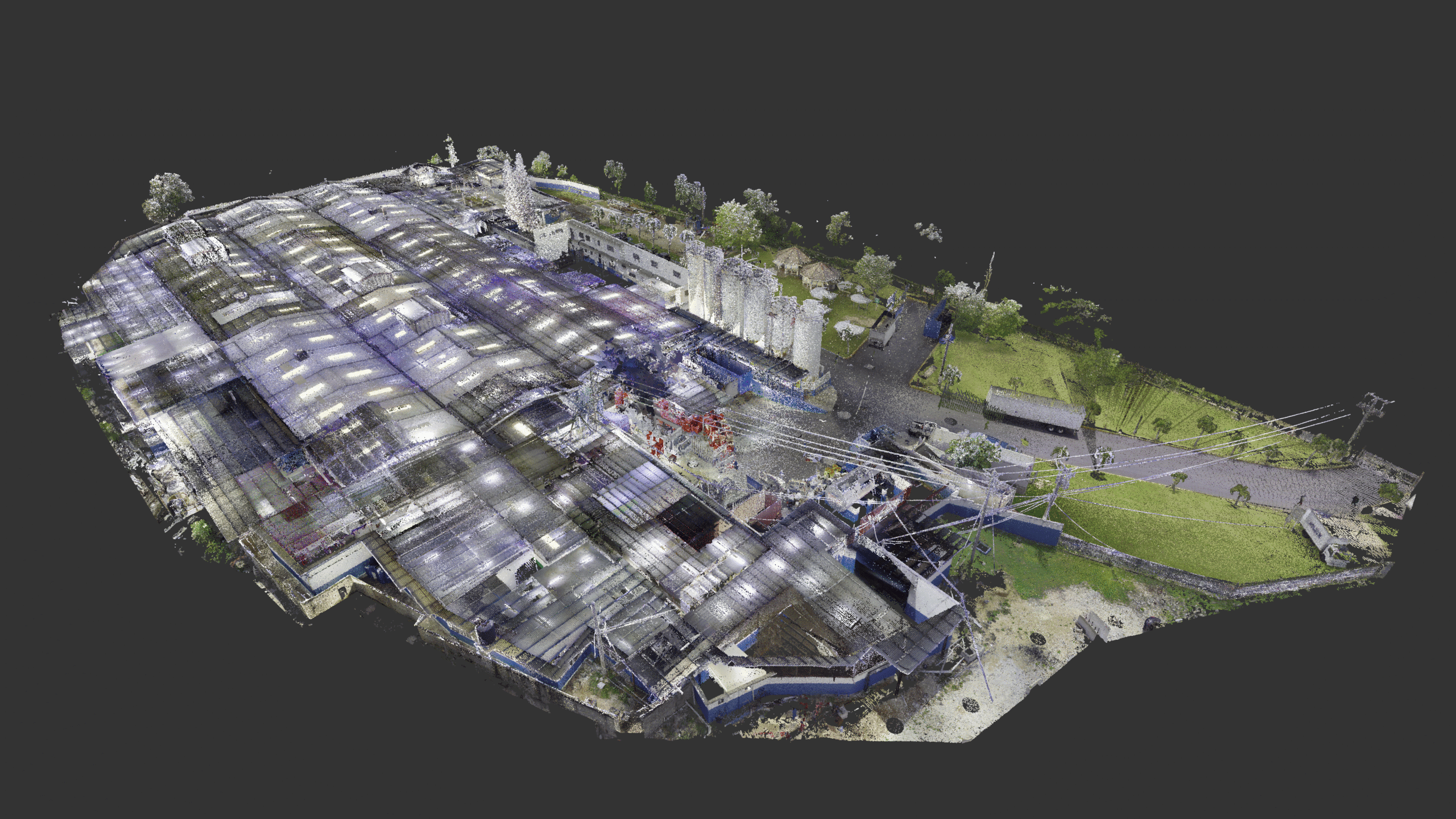
Facing outdated hand-drawn plant documentation and ambitious plans to expand production, an industrial bakery partnered with ENSOL Group to reimagine its layout. ENSOL, needing accurate as-builts to design remotely from the U.S., brought in OAR to scan and model the facility. OAR delivered a hybrid solution of 2D and 3D documentation—now hosted and shared via CINTOO—eliminating months of site visits and empowering global coordination.

The Challenge

A legacy food processing plant in Jamaica that grew organically over three generations. This resulted in: 

  • Fragmented infrastructure 
  • No reliable documentation 
  • Hand-drawn site drawings that didn’t reflect the current production setup 
  • Urgent need to reorganize for increased production over the next 18 months 


ENSOL Group, contracted OAR to create the new layout design, faced their own challenge: designing remotely without trustworthy as-builts would mean costly site visits and unreliable engineering data.

Our Solution

ENSOL turned to OAR to capture the entire facility with high precision and speed. OAR deployed a tailored scanning and modeling strategy:

  • Scanning: Entire facility scanned in 3.5 days using RTC360 
  • Deliverables: 
  • CINTOO-hosted colorized point cloud with 360° imagery 
  • 2D AutoCAD drawings for equipment layouts and reflected ceiling plans (aligned with integrator needs) 
  • 3D Revit model (LOD 300) for structural/architectural zones 
  • Plan views and exterior elevations to replace legacy hand-drawn documents 

OAR coordinated directly with plant management to gain access and complete the work swiftly and seamlessly.

The Results

  • 220,000 sq ft scanned 
  • 85,000 sq ft modeled in 3D 
  • Final deliverables delivered in under 4 weeks, including QA/QC 
  • ENSOL avoided months of site visits, saving thousands in travel costs 
  • Enabled ENSOL to begin 3D design work promptly and with high confidence 
  • Significantly improved coordination across stakeholders with mixed 2D/3D formats hosted on CINTOO 
  • Introduced topographic floor data for improved drainage planning  
  • Established a living digital asset that can evolve as equipment and layout change over time 

Gallery