


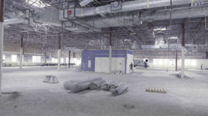
An engineering team designs a mechanical upgrade using the as-built drawings on file for a 1960s facility. The drawings show a straight duct run through a mechanical room. During construction, the crew finds a structural beam added during a 1990s renovation, sitting exactly where the new ductwork was routed. The design was executed correctly. The information it was based on was wrong.
This is a common pattern for engineering consultants, environmental firms, and MEP engineers working in buildings with any renovation history. As-built drawings are supposed to answer a simple question: what actually exists in this building right now? In practice, they often answer a different question: what did someone believe existed at the time the last drawing was updated. The gap between those two questions is where change orders, permitting delays, and field conflicts originate.
Table of Contents
As-Built Drawings, Record Drawings, and Existing Conditions Are Not the Same Thing
The terms get used interchangeably in casual conversation, but they describe different documents with different levels of reliability.
As-built drawings typically refer to the original construction documents, marked up in the field by the contractor to show what was actually installed versus what was originally designed. Record drawings are the cleaned-up version of those same markups, usually compiled by the architect or engineer of record from the contractor’s field notes.
Both documents share the same limitation. They depend on someone in the field noticing a deviation, marking it accurately, and passing that information along. Architects of record commonly disclaim responsibility for the accuracy of record drawings for this reason. The document is only as good as the fieldwork behind it, and that fieldwork happened once, at the time of construction. Every renovation, tenant fit-out, and repair since then is a new opportunity for the drawing set to fall further out of step with the building.
Existing conditions documentation asks a different question entirely: what is physically present in this space today, independent of what any drawing says was intended or installed. This is the category that 3D Laser Scanning produces. A scan does not reference the original design intent. It measures the room as it exists at the moment of capture, including whatever changes accumulated across every renovation the drawings never caught up with.
For engineering design work, that distinction matters more than it sounds. A design built on as-built documentation is a design built on an inference about the past. A design built on verified existing conditions is a design built on a direct measurement of the present.
Why Record Drawings Drift From Reality
Record drawings do not become inaccurate all at once. They drift, one undocumented change at a time.
A tenant fit-out reroutes a duct without updating the base building set. A maintenance crew relocates a valve during an emergency repair and never files the change. A previous renovation adds a wall, a beam, or a piece of equipment that gets noted in a punch list but never makes it into the drawing archive. None of these events is a failure on anyone’s part. They are simply what happens to paper documentation over years of normal building use.
The result is a drawing set that reflects a version of the building that stopped existing at some point in the past, sometimes decades ago. For a building with an active renovation history, the number of undocumented changes accumulates every time a new project touches the space.
What It Costs When Design Proceeds on Outdated Information
The cost of designing against inaccurate existing-conditions information shows up later in the project, when it is most expensive to fix.
The National Institute of Standards and Technology has estimated that inadequate interoperability across the U.S. capital facilities industry costs approximately $15.8 billion per year, with the majority of that burden falling on building owners and operators during the operations and maintenance phase. A meaningful share of that cost traces back to information gaps between what a drawing says and what a building actually contains.
Rework tied to inaccurate or incomplete information is a well-documented line item in construction budgets. Research from the Construction Industry Institute puts average direct rework at approximately 5% of total construction cost, with a wide range depending on project type and complexity. Industry survey data from FMI and PlanGrid found that miscommunication and inaccurate documentation together account for a substantial share of reported rework across the projects surveyed. Change orders tied to design and documentation errors are commonly cited in the 8% to 14% range of total contract value on typical projects, and higher on projects where field conditions diverge significantly from the original design basis.
For MEP coordination specifically, a clash discovered in the field, after equipment is fabricated or piping is roughed in, is far more expensive to resolve than the same clash caught during design. This is the core argument for verifying conditions before design begins rather than during construction, when the design team, the contractor, and the schedule all absorb the cost of the correction.
What Verified Existing Conditions Data Actually Provides
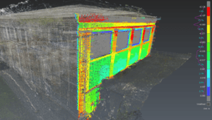
3D Laser Scanning produces a point cloud, a dense measurement of every visible surface in a space, captured directly rather than inferred from a drawing history. That data can be delivered at a level of accuracy and detail matched to how the design team plans to use it.
The industry uses two related but distinct standards to describe this. Level of Accuracy (LOA), defined by the U.S. Institute of Building Documentation, describes how closely the captured data matches physical reality, typically expressed in millimeters at a stated confidence level. Level of Development (LOD), defined through BIMForum’s guidance building on the AIA’s framework, describes how much information and geometric detail a model element carries, independent of how accurately it was measured. A model can be dimensionally accurate but generic in detail, or highly detailed but geometrically approximate. Specifying both LOA and LOD at the start of a project, rather than assuming one implies the other, keeps design and coordination teams aligned on what they are actually receiving.
The practical difference from traditional as-built survey methods is completeness as much as precision. A manual field survey captures a limited number of measured points, chosen by the surveyor based on what seems relevant at the time. A laser scan captures every surface in the space, including the beam, valve, or duct relocation that no one thought to note on a drawing because no one was looking for it. Conditions the design team did not know to ask about are still in the data.
For MEP coordination in particular, this level of completeness supports clash detection against actual conditions rather than assumed ones, which is where a meaningful share of avoidable field conflicts originate.
Why This Matters More in New England
New England’s building stock adds a regional dimension to this problem. Massachusetts and Rhode Island have among the oldest median housing and building ages in the country, well above the national median. Buildings of that age typically carry decades of renovation history, and each renovation is another point where a drawing set may not have been updated to match what was actually built.

Municipal decarbonization requirements are compounding this. Boston’s Building Emissions Reduction and Disclosure Ordinance requires large buildings to move toward net-zero emissions on a defined timeline, with similar ordinances in Cambridge and other municipalities. These requirements are driving a wave of MEP-heavy retrofit work, electrification, heat pump conversions, envelope upgrades, on buildings whose mechanical systems have often been altered multiple times since the original drawings were issued.
Historic district review adds another layer for renovation projects in areas like Boston’s Back Bay or Beacon Hill, where local commissions expect documented existing conditions as part of the review process. And much of the region’s water, wastewater, and industrial infrastructure dates back well beyond the buildings themselves, often with drawing records that predate digital recordkeeping entirely.
None of this is unique to New England. It is simply more concentrated here than in regions with newer building stock, which is part of why engineering consultants, environmental firms, and MEP engineers working across Massachusetts, New Hampshire, Maine, Vermont, Connecticut, and Rhode Island run into this gap between drawings and reality on a regular basis.
What This Means for the Design Process
The practical shift is straightforward. Before design work begins on a renovation, retrofit, or tenant improvement, verified existing conditions data gives the design team a direct measurement to work from instead of an inherited assumption. That data can be scoped to the level of accuracy and detail the project actually needs, whether that is a full building point cloud for a major MEP retrofit or a targeted scan of a mechanical room for a smaller upgrade.
For engineering consultants and MEP engineers, this means specifying LOA and LOD requirements as part of project scoping, the same way structural or mechanical requirements get specified. For environmental firms working on remediation or industrial sites, it means being able to document conditions with a level of detail that holds up through permitting and regulatory review.
OAR works with engineering consultants, environmental firms, and MEP teams across New England to capture verified existing conditions ahead of design, so the design proceeds from what is actually there rather than what an old drawing set assumed.
FAQs
What is the difference between as-built drawings and existing conditions documentation?
As-built drawings and record drawings are based on field markups made at the time of original construction, updated only when someone documents a subsequent change. Existing conditions documentation, produced through methods like 3D Laser Scanning, measures a space directly at the time of capture, independent of what any prior drawing recorded.
How accurate is laser scanning compared to traditional as-built surveys?
Laser scanning is typically capable of millimeter-level accuracy, with the specific tolerance depending on the equipment, range, and registration process used. The U.S. Institute of Building Documentation’s Level of Accuracy framework defines these tolerances at a stated confidence level so project teams can specify the accuracy a project requires. Traditional manual surveys measure a limited number of discrete points, while a scan captures the entire visible surface of a space.
Do I need existing conditions documentation for a permit application?
Requirements vary by jurisdiction and project type. Many permitting authorities and historic district review boards expect documented existing conditions as part of a renovation or alteration application, particularly for buildings with a significant renovation history or historic designation. Confirming requirements with the local permitting authority early in project scoping typically avoids delays later in the review process.
What is the difference between Level of Accuracy (LOA) and Level of Development (LOD)?
LOA describes how closely captured data matches physical reality, typically expressed in millimeters. LOD describes how much information and geometric detail a model element contains. The two are independent of each other, so a project scope should specify both rather than assuming one implies the other.