
3D laser scanning gives project teams a measured record of existing site conditions before design, coordination, renovation, or construction decisions are made.
For projects across the Northeast, that can be especially valuable when teams are working in existing buildings, active facilities, congested industrial spaces, or sites where available drawings no longer fully represent field conditions.
OAR provides field scanning across Connecticut, Massachusetts, Maine, New Hampshire, New York, Rhode Island, and Vermont. The goal is not simply to capture a site. It is to deliver field information in a form the project team can actually use downstream.
When Does 3D Laser Scanning Make Sense?
3D laser scanning is most useful when a project decision depends on knowing existing conditions accurately.
Common applications include:
- Renovation and retrofit planning
- Existing-conditions documentation
- BIM and MEP coordination
- Industrial facility modifications
- Equipment or system installation planning
- Design validation against field conditions
- As-built documentation
- Preconstruction planning
The size of a project alone does not determine whether scanning is valuable.
A relatively small renovation with dense systems, limited access, or irregular geometry may depend more heavily on accurate existing-condition data than a much larger but simpler space.
The better question is:
How much does the project depend on knowing what is actually there?
What Happens During a 3D Laser Scanning Project?
A scanning project typically moves through six stages.
1. Define How the Data Will Be Used
Before determining how much of a site needs to be captured, the project team should establish what the information needs to support.
That might include design, coordination, modeling, existing-condition documentation, facility planning, or another defined project use.
The intended use influences the scanning scope and the final deliverable.
2. Define the Capture Scope
Once the intended use is clear, the required areas and systems can be identified.
Depending on the project, that could mean:
- An entire building
- A specific floor
- Mechanical or equipment rooms
- Structural elements
- MEP systems
- Areas affected by a renovation
- Targeted interfaces or installation zones
Capturing only what the project needs can be more effective than collecting large amounts of data without a defined downstream purpose.
3. Plan Access and Mobilization
Before fieldwork begins, the scanning team coordinates the conditions that may affect site access.
These can include:
- Occupancy
- Active construction
- Safety requirements
- Restricted areas
- Site operating schedules
- Access windows
- Areas requiring special coordination
Occupied and operational facilities can often be scanned without taking the entire space out of service, but they generally require more deliberate planning.
4. Capture Existing Conditions
The scanning team captures the site from multiple positions so overlapping data can be combined into a coordinated dataset.
The specific field approach depends on the environment and project requirements.
Dense mechanical spaces, industrial equipment areas, open commercial spaces, and large infrastructure sites do not necessarily require the same capture strategy.
The purpose of the fieldwork is to document the conditions needed for the next project decision, not simply to maximize the volume of collected data.
5. Register and Process the Data
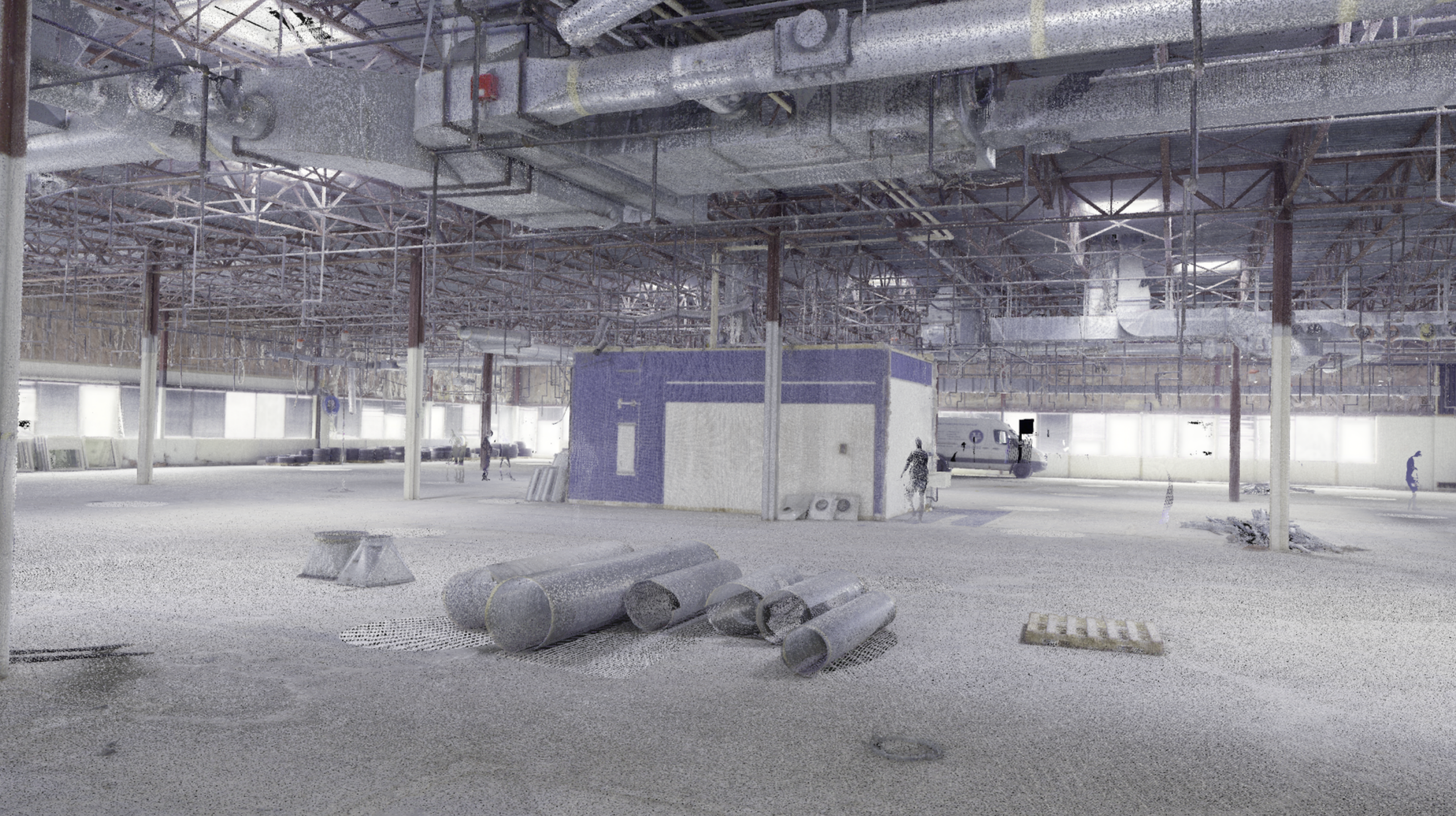
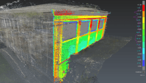
Individual scans are combined into a registered point cloud representing the captured geometry of the site.
That point cloud becomes the measured digital record from which additional project information can be developed.
Processing requirements vary based on site size, capture scope, and the final deliverable the project team needs.
6. Prepare and Deliver the Required Information
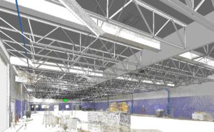
Depending on project requirements, scan data can support deliverables such as:
- Registered point clouds
- Revit models
- 2D existing-condition documentation
- Project-specific digital models
- Data prepared for downstream design or coordination workflows
File format and software requirements should be established before the project begins.
An accurate deliverable is only useful if the team receiving it can incorporate it into its existing workflow.
What Should Be Defined Before Mobilization?
One of the most important decisions happens before a scanner arrives on site:
What will the project team do with the information after it is captured?
That answer helps determine the appropriate scope, deliverable, and level of detail.
Before mobilization, project teams should be prepared to discuss:
- What decisions will the data support?
- Which areas need to be documented?
- Which systems or elements matter most?
- What does the design or construction team need to receive?
- What software or file formats will the team use?
- Are there project coordinate requirements?
- Are there occupancy, safety, or access constraints?
- When is the information needed?
Defining these requirements early helps connect field capture to an actual project outcome.
What Is a Point Cloud?
A point cloud is a digital dataset made up of measured points that represent the geometry of a physical environment.
After scanning, individual scan positions are registered together to create a coordinated representation of the captured space.
Project teams can use the registered point cloud directly as a spatial reference or use it as the basis for additional documentation and modeling.
The point cloud is therefore not necessarily the end product.
For many projects, it is the starting point for creating information that designers, contractors, fabricators, coordinators, or facility teams can use in their existing workflows.
What Deliverables Can Be Created From 3D Laser Scanning?
The appropriate deliverable depends on what the project needs to accomplish.
| Deliverable | What It Provides | Common Project Use |
|---|---|---|
| Registered point cloud | Measured spatial record of captured conditions | Existing-condition reference, coordination, validation |
| Revit model | Modeled representation developed from scan data | Design, BIM coordination, renovation planning |
| 2D documentation | Drawings developed from measured conditions | Existing-condition documentation, design reference |
| Project-specific digital deliverable | Information structured around a defined workflow | Coordination, planning, digital delivery |
More detail is not automatically better.
The right deliverable is the one that provides the level of information required for the next project decision without adding unnecessary modeling or processing.
How Does the Scanning Approach Change by Project Type?
Different project environments place different demands on field capture.
| Project Type | Typical Capture Priorities | Common Downstream Uses |
|---|---|---|
| Commercial renovation | Architecture, structure, ceilings, building systems | Design and renovation planning |
| Industrial facility | Equipment, structural conditions, mechanical systems, congested areas | Retrofit, coordination, installation planning |
| Infrastructure | Existing geometry and broader site conditions | Design and documentation |
| Occupied facility | Required systems combined with access and operational constraints | Phased renovation and facility planning |
These are not rigid categories.
The capture strategy should ultimately be driven by the project requirement rather than the building label.
Can 3D Laser Scanning Be Used in an Occupied or Active Facility?
Yes. Many existing-condition projects take place in buildings or facilities that remain operational.
These projects may require additional coordination around occupancy, production schedules, restricted spaces, safety requirements, or access windows.
Identifying those constraints during project scoping allows the field team to plan the mobilization around site operations rather than treating access as an issue to solve after work begins.
How Long Does a 3D Laser Scanning Project Take?
Field and processing timelines depend on several variables, including:
- Site size
- Geometry and density
- Access restrictions
- Required coverage
- Site operating conditions
- Final deliverable
- Required modeling detail
For that reason, scanning duration and delivery schedule should be established during project scoping rather than assumed from square footage alone.
A dense industrial environment and an open commercial floor of the same size may require very different field and processing efforts.
Why Define the Deliverable Before the Scan?
Scanning produces a large amount of spatial information.
But collecting more information does not automatically create more project value.
A project intended to support MEP coordination may require a different capture and modeling strategy than one intended to document architectural existing conditions.
Similarly, a team that needs a registered point cloud may not need the same processing effort as a team that requires a Revit model.
Defining the intended deliverable before mobilization helps align:
capture → processing → delivery → project use
That connection is what turns field measurement into usable project information.
3D Laser Scanning Across the Northeast
OAR provides field scanning across:
- Connecticut
- Massachusetts
- Maine
- New Hampshire
- New York
- Rhode Island
- Vermont
Extended coverage can be supported for larger programs.
OAR’s BIM Coordination & Virtual Construction and Digital Delivery & Implementation services are available nationwide.
This allows field information captured in the Northeast to continue into broader digital project workflows when additional coordination, modeling, or implementation support is required.
What Should You Send When Requesting a Scanning Scope?
You do not need to have every technical requirement resolved before starting the conversation.
Useful information includes:
- Project location
- Approximate area or scope
- Type of facility
- Areas or systems that need to be captured
- Intended use of the data
- Required deliverable, if already known
- Existing design or reference files
- Access or operating constraints
- Target delivery date
From there, the capture and delivery scope can be aligned with what the project team actually needs.
Scope a 3D Laser Scanning Project
If your project depends on accurate existing conditions before design, coordination, renovation, or construction begins, OAR can help define a scanning and delivery scope around the information your team needs.