
Existing Conditions Documentation for Waterfront Infrastructure
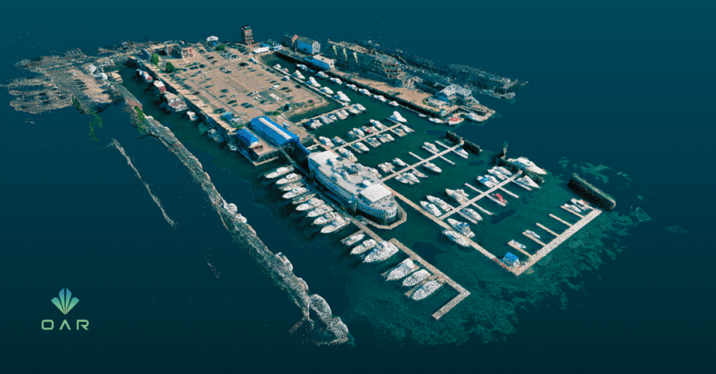
Waterfront Existing Conditions Documentation
For this marina improvement project, OAR created a digital representation of existing dock and pile conditions and organized related inspection information into project deliverables.
Project Need
The project team needed current spatial documentation for planning future waterfront improvements. The scope included approximately seven docks and roughly 100 piles.
OAR Scope
- Field capture and registered point-cloud processing
- Modeling of docks and piles
- Geolocated Revit model and 3D site representation
- 2D plans and a pile schedule
- Integration of client-provided dive-inspection information
Combining Geometry With Inspection Information
The client supplied pile inspection records. OAR incorporated the associated condition categories, Replace, Consider Replacement, and Replacement Not Required, so that geometry and inspection information could be referenced together.
Technical Boundary
The condition classifications came from the client-side inspection process. OAR captured and organized geometry and incorporated the supplied records. Engineering conclusions about structural adequacy and pile replacement remained with the responsible professionals.
Supporting Waterfront Planning
Combining measured geometry with inspection information gave the team a structured existing-condition record for planning repairs and improvements.
Registered point cloud
Geolocated Revit model with dock and pile geometry
2D plans and pile schedule
Integrated client-provided inspection information
Planning improvements around docks, piles, or other difficult-to-document infrastructure?
OAR can help turn field conditions into usable digital information.