Maine Farmhouse: One Day of Scanning Replaces Every Site Visit for a Two-State-Away Architect
The Project
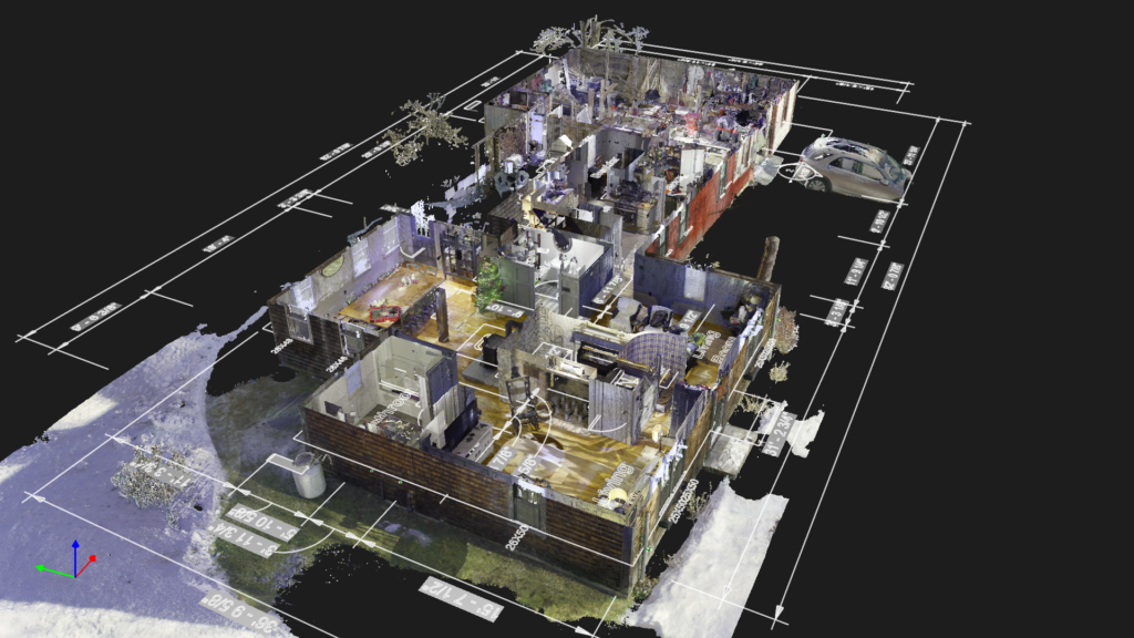
A remote residential renovation required documenting the existing conditions of an aging farmhouse property in Western Maine so that an architect located two states away could design the remodel without repeated site visits. OAR used scan-to-plan technology, high-accuracy LiDAR scanning, 360-degree imagery, and the Cintoo platform to enable a smooth design process without manual measurements or travel.
Outdated records. A remote architect. No margin for rework.
The property, built decades ago, had outdated or incomplete records of its layout and structure, posing real risk for design errors and unforeseen complications during construction. The architect needed a reliable digital solution to assess the property without frequent site visits. The structure’s age and complexity made traditional manual measurement inefficient and error-prone, raising the likelihood of costly rework.
Capture it once. Let the architect work from anywhere.
High-Precision Reality Capture & 360-Degree Imagery
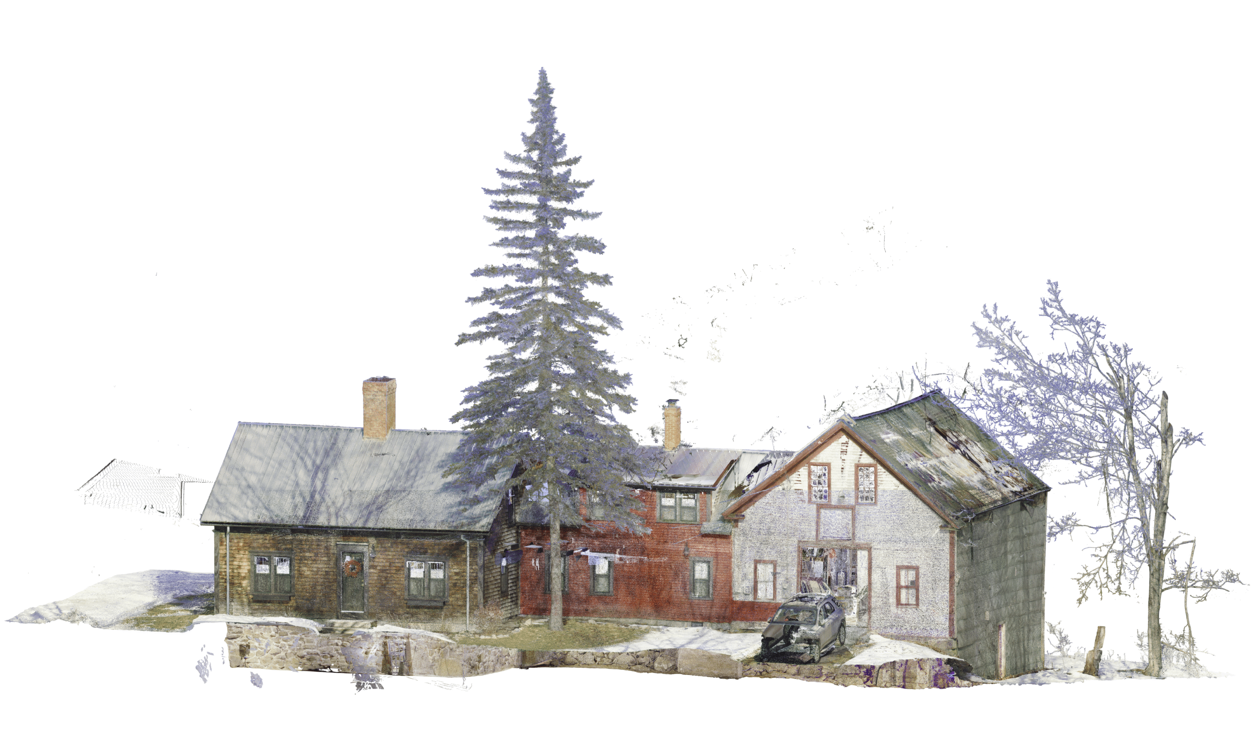
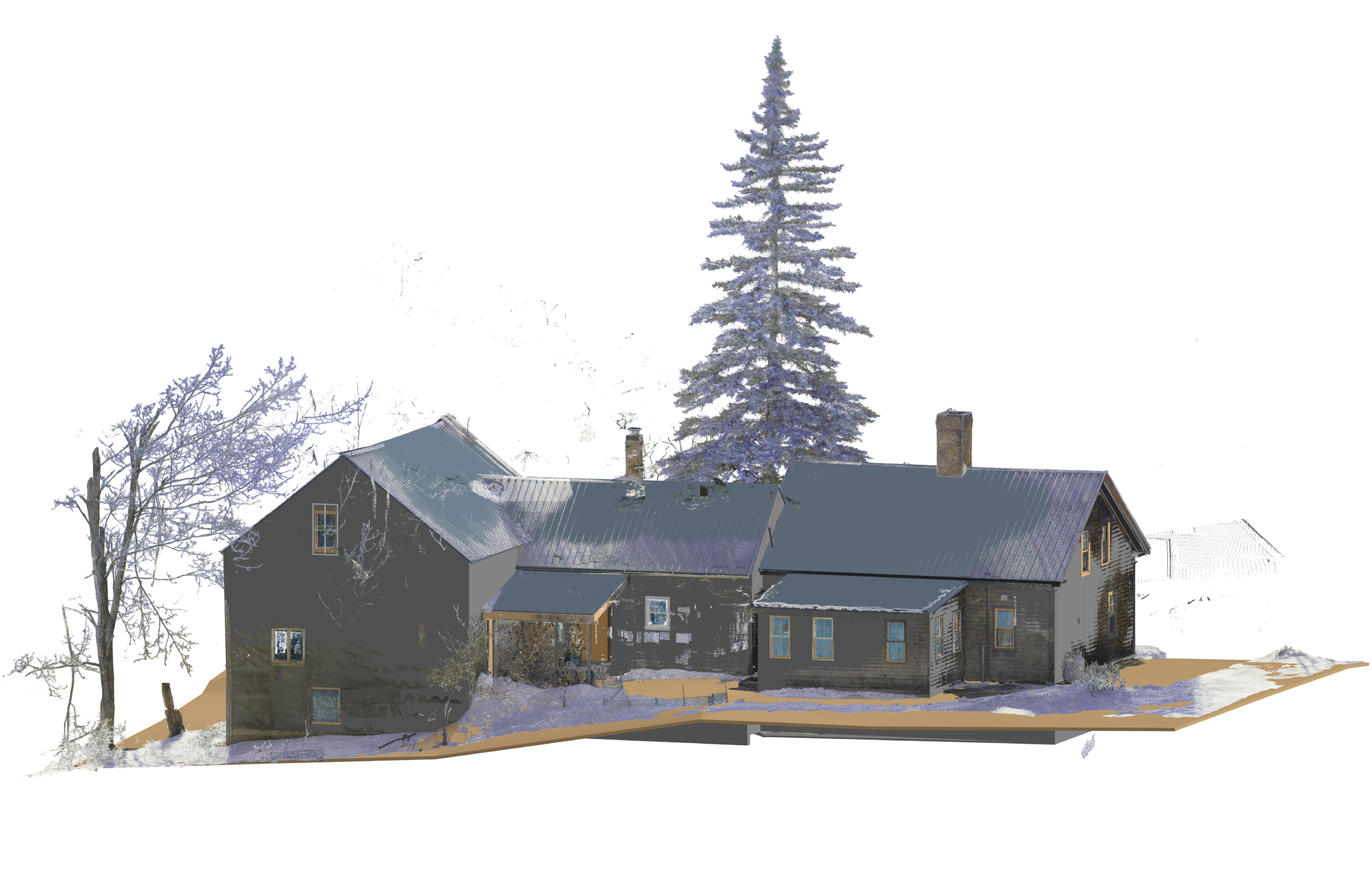
OAR performed a complete LiDAR scan of the entire property, capturing both interior and exterior in detail. The scan produced an ultra-precise point cloud fully representing the existing conditions, including structural elements crucial to the remodel. High-resolution 360-degree photos provided an immersive visual reference from all angles. All scanning and photography were completed in a single day.
Remote Access via Cintoo
All scan data and 360-degree photos were hosted on the Cintoo platform, enabling the architect to remotely measure, analyze, and assess site conditions without a single physical visit to the property. The platform made it easy to toggle between point cloud and imagery for a complete assessment.
3D and 2D Deliverables
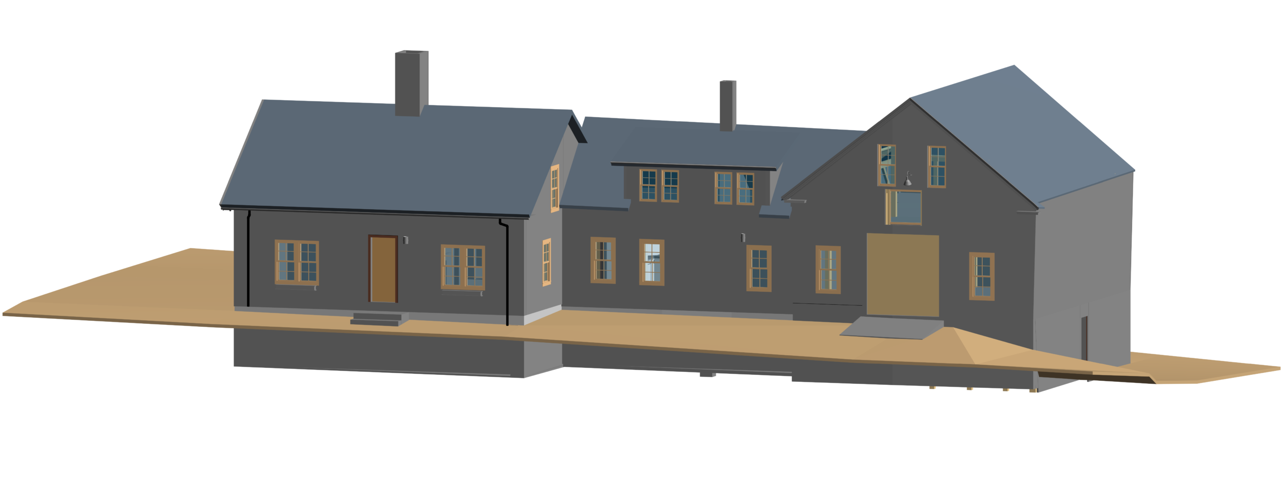
OAR delivered a precise 3D Revit model of the property along with 2D plans, sections, and elevations, ensuring compatibility with the architect’s design workflow and providing both digital and traditional documentation for the remodel.
One day of data collection. Zero site visits for the architect. Design-ready documentation from day one.
Comprehensive scans and photos eliminated the need for manual measurements, reducing errors and ensuring precise documentation. With remote access to Cintoo-hosted data, the architect avoided 5+ site visits and worked effectively from two states away. The precise point cloud and 3D model minimized the risk of design inaccuracies, and the single-day data collection enabled the architect to begin design work immediately.
Registered point cloud: full property capture (interior + exterior) in a single day
360-degree imagery: immersive visual reference from all angles
3D Revit model of existing conditions
2D plans, sections, and elevations
Remote access via the Cintoo platform